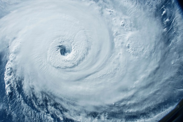
Up to 10 Named Storms Forecasted During ‘Supercharged September’

By: Olivia Overman
The U.S. is forecasted to face between 6 to 10 named storms from Aug. 27 through Sept. 30, according to experts at AccuWeather. Following a brief lull in tropical activity in the wake of Hurricane Ernesto, the conditions are now primed for a series of back-to-back storms over the next few weeks in the Atlantic.
“We could see a parade of storms developing during the month of September,” says Alex DaSilva, lead hurricane expert at AccuWeather. “There’s a possibility that we could see multiple tropical storms and hurricanes in the Atlantic basin on the same day, similar to the frequency of storms that we’ve seen during other supercharged hurricane seasons like 2020. The statistical peak of the hurricane season is Sept. 10, and we expect the Atlantic basin to be incredibly active.”
Currently, dry air and Saharan dust are limiting the development of tropical storms. However, these inhibiting factors are expected to ease in the final days of August, boosting the risk of tropical storms.
“With less Saharan dust and dry air expected in the coming weeks, we could see those tropical waves take advantage of very favorable conditions,” DaSilva says. “With extremely warm water temperatures, less disruptive wind shear, and less dry air, we could see a storm organizing every few days.”
This data runs parallel with new research indicating that the frequency of deadly hurricanes has increased by 300% meaning that what used to be the 100-year hurricane is now predicted to occur every 25 years, according to Deep Sky Research, a Montreal-based carbon removal project developer.
Deep Sky Research’s model also projects losses of more than $450 billion in the next five years across Gulf and South Atlantic coast states due to hurricanes.
The impact from these storms is far-reaching, with storms extending further inland, according to AccuWeather experts.
“The inland impacts we’ve already seen from hurricanes this year are a vivid reminder that everyone needs to be prepared across much of the eastern United States, even if they live hundreds of miles from the coast,” DaSilva says. “Hurricane Beryl made landfall along the Texas coast, but that storm spun up dozens of destructive tornadoes as it moved inland from the Gulf Coast all the way to upstate New York, more than 1,400 miles away.”
Further, flash flooding is a particular concern for several regions along the East coast, according to Jon Porter, chief meteorologist at AccuWeather.
“Some areas of the mid-Atlantic and Northeast have received 200%-300% of the historical average rainfall in the past 30 days,” Porter said last week. “The ground is saturated and additional rainfall can quickly runoff, resulting in renewed flooding concerns. Any new tropical threats that bring heavy rainfall to the Carolinas, mid-Atlantic, and Northeast could quickly cause more flash flooding, which is a major concern in September.”
A changing climate suggests that the number of more powerful storms will continue to intensify and people and businesses will need to be prepared for the impacts.
“The frequency of coastal flooding along the Gulf and East coasts of the U.S. has greatly increased over the past 60 years, with a notable acceleration since 2010,” says Brett Anderson, senior meteorologist and climate expert at AccuWeather. “The rate of hurricane intensification has also significantly increased along the U.S. Atlantic coast over the past 40 years, likely due mostly to warming waters. This trend is projected to continue over the coming decades.”
Olivia Overman is IA content editor.


