Opportunities Abound for Private Insurers in the U.S. Flood Market
By: Justin Smith
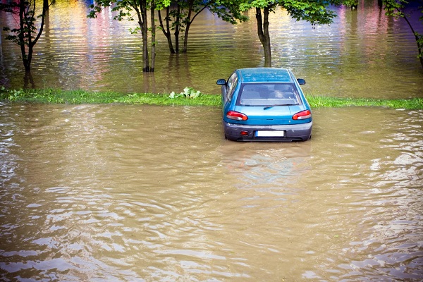
Flooding is the No. 1 natural peril in the U.S. Yet, only about 15% of U.S. homeowners purchase flood insurance, and most obtain their coverage through the National Flood Insurance Program (NFIP), according to the National Flood Services organization.
The resulting gap in protection could be as much as a $40 billion opportunity for private insurers to play a larger role in the flood market, particularly since the NFIP has struggled with insolvency for decades.
The Federal Emergency Management Administration (FEMA) manages NFIP and its policies, which can be purchased directly from FEMA or through FEMA-authorized private carriers known as “Write-Your-Own” (WYO) insurance carriers.
For the past 40 years, FEMA’s primary tool for managing and pricing flood risk are the maps they develop. However, private carriers see serious problems in using these maps to calculate the exposure and the aggregation risk, such as:
- Many of the maps are outdated—some haven’t been updated in over a decade.
- Frequent flooding exists outside designated flood zones, indicating underlying trends such as rapid urbanization are changing the risk.
- They rely on historical statistical techniques that don’t include a risk accumulation metric.
Notably, Risk Rating 2.0, FEMA’s new pricing methodology for the National Flood Insurance Program (NFIP), went into effect Oct. 1, 2021, and is intended to correct many of these inefficiencies and support both a flourishing private and public market.
Hurricane Harvey, the Category 4 hurricane that hit the south-central coast of Texas in 2017, was a lesson in the limitations of flood mapping. Seventy-five percent of the claims from Harvey were outside the Special Flood Hazard Area (SFHA), according to CoreLogic. SFHAs are high-risk areas defined as land that would be inundated by a flood having a 1% chance of occurring in any given year.
Since Hurricane Harvey, new technology has given underwriters a better understanding of the physics of flooding and a more realistic view of the risk. For example, when water flows over a levee or riverbank, it fans out in multiple directions, making those floodwaters largely unpredictable.
More advanced modeling techniques make it possible to develop more realistic predictions for these scenarios. They can be coupled with high-resolution typography satellite data and land use information to give a more accurate picture of where and how flooding can occur.
Moreover, new catastrophe modeling tools can help insurance companies underwrite, price and manage flood portfolios. They combine climate and weather models and include advanced modeling of tropical cyclone precipitation. They also better reflect current conditions and allow underwriters to quantify risk by industry, region or individual property. Additionally, loss estimates can be provided in real-time and underwriters can run scenarios to estimate future events and losses.
The fact that all 50 states have experienced floods in the past five years—with so few homeowners covered by insurance—creates an urgent situation. But will homeowners purchase it willingly? The answer to this question and exactly what private participation in the flood insurance market will look like remain to be seen.
Technology in the hands of underwriters who understand flood risk and can work effectively with governments and the public to help mitigate the risk seems to be the most promising solution.
Justin Smith is chief underwriting officer of Applied Underwriters.
This month’s issue

The June issue is out now!