What Independent Agents Should Know About Today’s Changing Flood Risk
By David Tobias
Flood used to be an easier conversation: check the map, confirm the zone and explain whether coverage is required. But that shortcut is breaking down. Clients still ask, “I’m not in a flood zone, so I’m fine, right?” And more often, the honest answer is “not necessarily.”
Flood maps are foundational tools for underwriting and compliance, but they are regional by design. They were never meant to capture every property-level factor that influences how water moves.
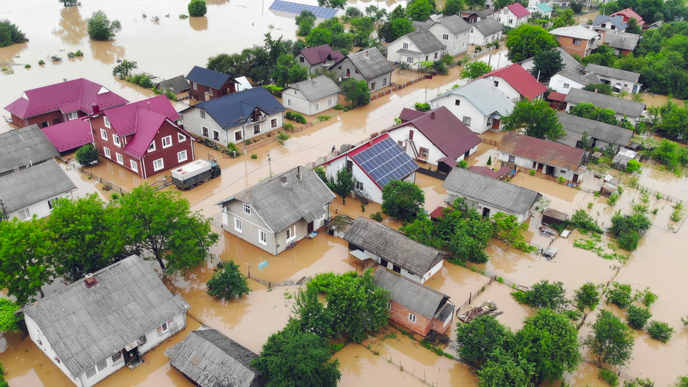
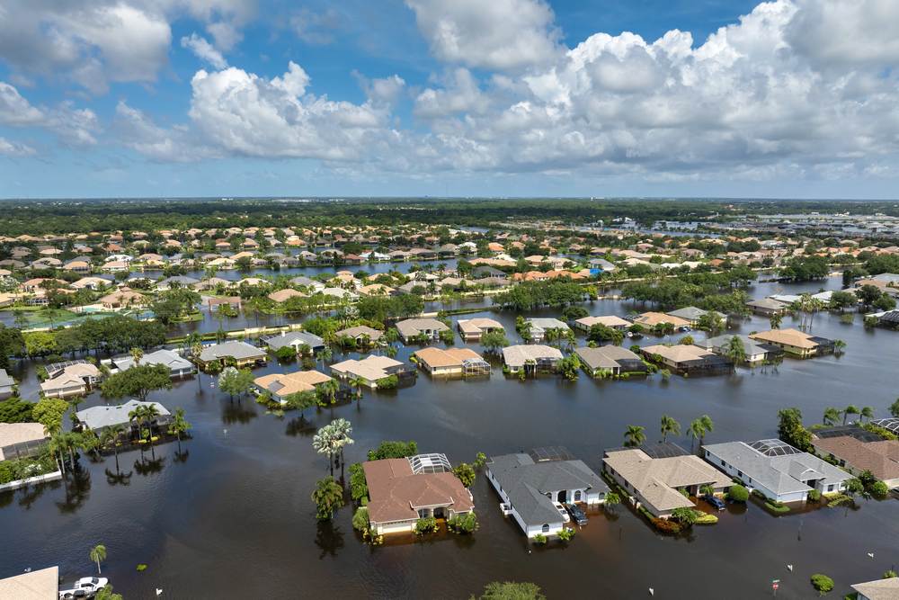
Over the past decade, nearly one-third of National Flood Insurance Program (NFIP) claims have come from outside high-risk flood areas. At the same time, data from the National Oceanic and Atmospheric Administration (NOAA) shows that heavy precipitation events have increased in frequency and intensity across much of the U.S.
Rainfall-driven flooding, overwhelmed stormwater systems and runoff from new development are increasingly common drivers of loss. Those realities do not always align neatly with a zone boundary.

Take the 2026 Agency Universe Study Survey
For agents, this creates a familiar but uncomfortable moment: The map may show moderate or low risk but the property and the weather patterns affecting it may suggest something more nuanced.
One of the most practical realities agents see is how conditions can vary over short distances.
A home that sits a few feet lower than its neighbors may collect runoff during a heavy storm. Another may be near a storm drain, culvert or ditch. A nearby subdivision built five years ago may redirect water in ways that were not there when the map was last updated.
On paper, these properties can look identical. Same ZIP code. Same flood zone. Similar construction. In practice, however, they do not have the same exposure.
This is why two clients with the same ZIP code may need two different answers to their coverage needs. The map is a starting point, but it does not replace a closer look at how water is likely to behave around a specific structure.
Explaining that nuance to clients can be challenging if the conversation stays abstract. Aerial imagery and property-level data make flood risk easier to discuss because they allow agents to show what they are seeing: slope toward the structure, low points in the yard, drainage paths, nearby development or changes over time.
When clients can see those features, the discussion shifts. It is no longer a theoretical debate about zones. It becomes a practical conversation about how water might move during a significant rain event.
More agencies are incorporating property intelligence and artificial intelligence (AI)-powered insight layers, including tools like Nearmap, to bring that visual context into the conversation without turning it into a science lesson. The point is clarity. When clients can see the exposure, they are better equipped to understand it.
More on Flood

It means making sure clients understand that “not required” does not get mistaken for “not worth considering.” That distinction matters, especially in areas where lender requirements drive most flood purchases. When the requirement is absent, the agent’s explanation carries more weight.
This approach can be especially helpful at renewal, when clients are reviewing costs and deciding what to keep and what to cut. If flood coverage is on the table, revisiting the property context can ground the discussion. If it was previously declined, that renewal conversation becomes another opportunity to confirm the client understands the exposure.
Further, flood conversations also intersect with professional liability considerations. If a client declines flood coverage and later experiences damage, the questions become straightforward: Did we clearly discuss it? And did we document that conversation?
Agencies have always documented these conversations—what is changing is the type of supporting information available.
Saving a snapshot of the property context, including imagery, historical views and notes about drainage or slope can help demonstrate that the recommendation was grounded in observable exposure. It shows the advice was specific to that property, not a generic warning.
For agencies managing errors & omissions risk, that documentation can be as important as the recommendation itself.
Flood risk is evolving, and the conversations agents have with clients are evolving with it. What used to be a binary question—inside the zone or outside it—is increasingly a broader discussion about how water behaves around a specific property.
Technology is helping make those discussions clearer but, ultimately, it is the independent agent who translates that information into guidance a client can act on. When that conversation is grounded in observable facts, clients gain something they value just as much as coverage: confidence that they understand the risk in front of them.
David Tobias is chief product officer at Nearmap.
Agency Management Solutions
Insurance Markets
This month’s issue
The April issue is out now!